Wednesday, January 9, 2013

Eating Pineapples and Fording the Oueme

January 7 - 8

Day #11Started : Come                            Ended: Zinvie                                     Distance Covered: 78 km
Day #12Started : Zinvie                             Ended: Ahoueda                                Distance Covered: 43 km


Highlights
  • Pineapples
  • Canoe river crossings
  • 110% Humidity

Click on the images below to enlarge
A ferry taking part of our
group 
across the river
An enormous church just

outside of Allada
Harvesting pineapples

in the fields.

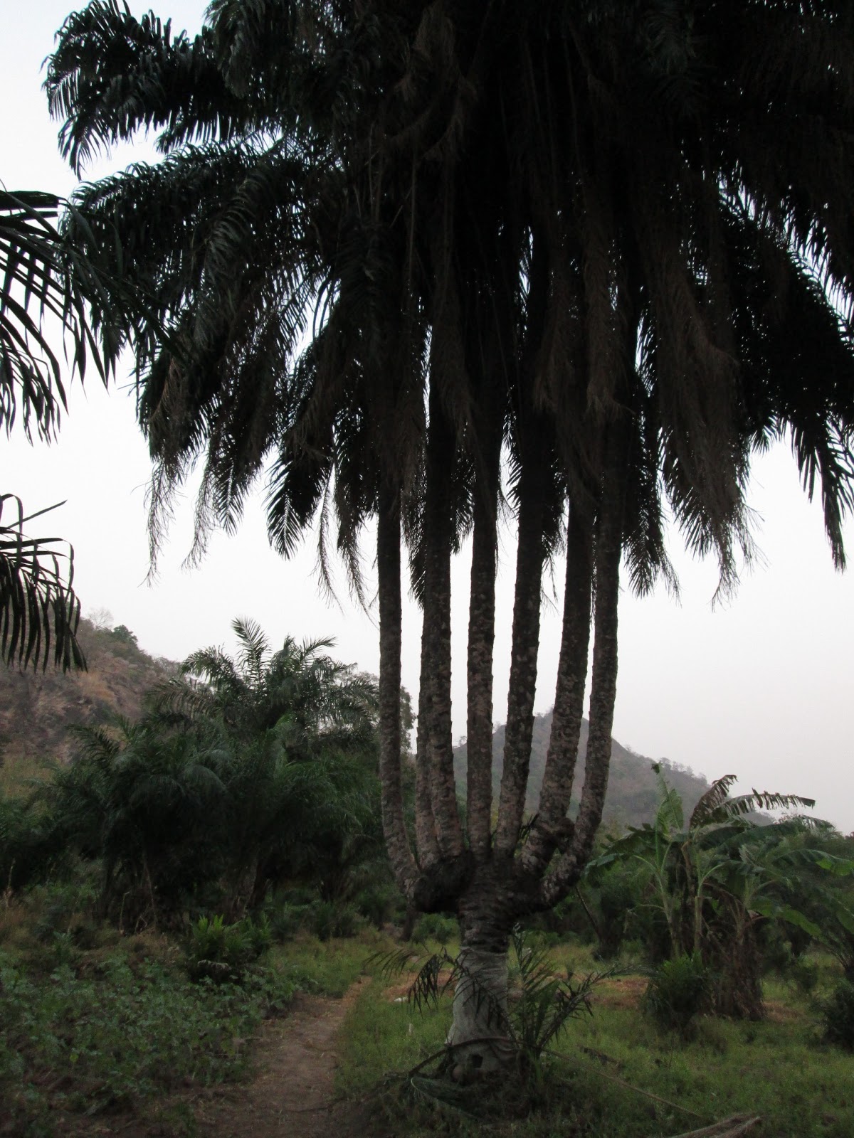
The last two days have been some of my favorite of this trip so far.  We’ve been crossing the south of the country from the west to the east, and the scenery has been completely gorgeous.  Many of the trails have been small, dirt paths that run alongside lakes and rivers, and they’ve been lined with palm trees and pineapples.  The only down side has been the ridiculous humidity; it seems like it only takes 30 minutes before our shirts are completely drenched in sweat each morning.

A truck being packed with pineapples to take to market
On our way from Come we passed through the city of Allada, which is the pineapple capital of Benin.  This time of the year is the height of the pineapple season as well, which means that they’re everywhere!  I couldn’t count the number of pineapple we saw; just about every other field seemed to be filled with them, and just about every market corner seemed to have a vendor selling them.  And to top it off, people are incredibly generous with the pineapples as well.  Throughout our day-long trip to Zinvie, we were given a total of 10 pineapples as gifts along the way.  Needless to say, dinner that night was pretty sweet.


From Zinvie, our route caused us to face the daunting task of fording the Oueme River.  This region is a flood plain, so during the majority of the year the roads and fields found there are nonexistent (since they’re inundated).  As it’s currently the dry season, the water has gone down, but the roads are still barely established.  With the water level low, we were able to pass through most of the flood plain on a peninsula that runs between diverging streams, but it was extremely slow going.  It takes time for foot traffic to even out the paths here, and then they are simply destroyed months later when the rains return.

Homes are built on stilts to
avoid flood waters
To cross parts of the river that were too deep to cross by foot, we took canoes (which was awesome, though a bit shaky).  Villagers in this area frequently use canoes to ferry between villages on opposing sides of the river and to transport goods to markets up- and down-stream.  The canoes are made from trees that have been felled and hollowed out.  They’re pretty well crafted, but they require a bit of baling each time you use one.


The contraptions within the boats
are used to catch fish
From our trip across the peninsula it became apparent that the people of this region are very adept at living within their environment.  They take advantage of the benefits the river brings them, but they are also aware of its strength.  Many people make a living by fishing or by cultivating the rich flood plains once the water in them has receded.  To survive the floods, though, they must build their homes on stilts and be prepared to constantly repair them.  It’s pretty amazing that a community so close to others in the country can have such a unique manner of living solely due to the conditions they are faced with.


Starting tomorrow we’ll be heading back north, making our way to the city of Ketou, and then alongside a sacred forest to our midway point in the town of Save.  Ketou has a pretty big voodoo influence, and January 10th is one of the largest voodoo celebrations in Benin, so we may time it just right to see some interesting things.

Monday, January 7, 2013

The Ocean's a Callin'


January 5 – 6

Day #9Started : Klouekanme                  Ended: Grand Popo                        Distance Covered: 101 km
Day #10 – Started: Grand Popo                  Ended: Come                                  Distance Covered: 18 km

Highlights
  • Side road sidetracks
  • Bite of Benin
  • Some R & R (a.k.a. - bike maintenance & laundry)

Click on the images below to enlarge

A boy looking after his
family's cows as they  graze.

Rows of the centers from palm
leaves. Many
people use this light, 
solid 
material for construction.
Some of the back roads we took
included some sweet obstacles!


As I explained earlier, due to lack of electricity and internet connectivity, it’s been a bit difficult to update the blog each night as I had hoped.  The posts have still been getting written, though, so if you’re able to neglect the dates that website says these posts are going up – it’s all good.

There are two new posts below this too, so don’t miss those!

The last two days have been a race to the beach.  We've been biking hard for nearly a week and a half now, and we finally made it to our southernmost point at Grand Popo.  Grand Popo is a pretty quiet beach community that's been somewhat developed by tourism, but I think it's got a huge potential to grow given a bit of strategic investment.  It’s shore is part of the “Bite of Benin”, which is home to some viscous side currents and enormous waves that break just meters from the shore.  Going into the ocean here is a blast, but you’ve got to be smart about it – some of the waves can really mess you up (and a lot of people are actually killed by them each year).

The landscape we passed in reaching Grand Popo really emphasized how much the environment has changed since leaving Natitingou on Day 1.  Everything was so dry when we started.  Now it’s as lush as can be: there are palm and coconut trees everywhere, market stands are filled with varied assortments of fruit, and my nostrils are no longer cemented with sandy boogers!

We’re taking it easy for a day on the beach, giving us some time to fix our gear up and give our bodies a break.  The next week looks like it’ll be full of some hard stretches, but the rides should be really beautiful too.  We’ll be going on trails alongside a lot of major rivers, finding some canoes to ford us across the Oueme, and visiting the stilt villages in Dangbo.  More to come soon!


Laundry's done and the ocean's ready


Chameleons and Kings in Abomey


January 4

Day #8Started : Bohicon                           Ended: Klouekanme                      Distance Covered: 48 km

Highlights
  • Chameleon Vodoo Temple
  • Royal Palace/Museum of Abomey


Today we paid a visit to one of the more touristic centers of Benin – Abomey.  Before reaching the city with its lines of palaces and commonly-visited sites, though, we got to a chance to tour something much less well-known.
A voodoo temple shaped like a chameleon.  Chameleons 
are said to be symbolic of god on earth to most
divinities of voodoo.


Due to some awesome connections that one of our fellow volunteers has, we got to visit a voodoo temple shaped like a chameleon.  It’s huge!  It's been under construction for the past 6 years, and although there is still much to be completed within it, it looks pretty remarkable.  I mean, who doesn’t think walking into the mouth of a chameleon to get into a temple is cool?!

The temple is a private project being financed by a voodoo priest who resides on the outskirts of Bohicon.  Its purpose is not to serve as a tourist attraction, but as a place for followers of the Tohouiyo divinity to worship.  I'm not too well versed in the theology of all the different deities and spirits within Voodoo, but I can tell you that there are many.  Voodoo is a polytheistic religion, and one may find a spirit involved in just about anything.

We had the chance to talk with the voodoo priest who was financing the temple, and he told us that many people claim that different religions – Christianity, Islam, etc. – are all different things.  He said that when one understands Voodoo, however, they understand that they are all the same.  Everything is a part of Voodoo.  For example, he said that the God that one worships in Christianity is also one of the Gods worshipped in Voodoo. 

This statement matches up almost to a tee with what I’ve heard when discussing voodoo with other Beninese people as well.

After the chameleon voodoo temple, we took a tour of the Royal Palace and Museum of Abomey.   These two places are combined into one, established within the grounds that used to be the palaces of King Gelele and his son King Guezo (when they were alive).  Nowadays, there are a lot of displays within the palaces explaining the culture and history of this southern region of Benin. 


We witnessed part of a huge ceremony being put on
for the king of Abomey when we arrived at the palace.
Tons of people were partaking in the procession and
also standing by to watch; apparently it was the first
time this particular ceremony had taken place in 40
years.
The tour is packed with loads of interesting information (tours in French or English too!), and there’s no way I can really do it justice.  Taking pictures within the royal palace is also forbidden, so I have none to show.  However, if your travels ever take you to this region of Benin, I would highly recommend visiting this museum.  You will come to understand the spread of the Fon people throughout Benin, see a king’s throne that is mounted atop the skulls of four enemy kings and a King’s tomb whose walls were built with the blood of 41 people, and you might even witness a traditional ceremony going on within the palace walls.


Abomey’s a very cultural place, and even though it is a bit touristy, I think there’s a load of history to pick up if  you look in the right places.

 
A small house made from machetes.  Abomey is also
home to some pretty innovative artists


Tchetti and the Man-Eating Mountain

 January 3

Day #7Started : Tchetti                             Ended: Bohicon                        Distance Covered: 93 km

Highlights
  • Hidden shrine
  • Zangbetos

Click on the images below to enlarge them.

The land between Tchetti and
Djidja is filled with scenic, 
open fields such as this one.
A Zangbeto.  These
dancing haystacks are
known as the protectors
of the night, but during
this time of the year they
are often found at various 
important celebrations
A sacrifice 
on the road
to Bohicon that I nearly passed
by. 
It appears that
the person making the offer
created a circle with cinders
and offered up a bottle of palm
oil and a chicken.  The building
in the back is a shrine.


As our trip starts to take us further south, we are beginning to encounter more forms of traditional beliefs, in particular in the forms of shrines and fetishes.  Note that the term “fetish” does not nearly hold the same connotation in as it does in the United States.  In Benin, a fetish is simply some object (or occasionally a place in nature) that is said to serve as a home to a given spirit.  Thus, those who believe in the fetish and its spirit’s powers will often maintain the areas in which these relics are found and occasionally pay tributes to them.  Tributes frequently include offerings of palm oil, strong liquor, and animal sacrifices.

One of the mini-mountains that the village of
Tchetti is built around
After spending the night in the town of Tchetti, part of our team decided to wake up early and explore one of the nearby mini-mountains.  Normally these hills are off-limits to simple passer-bys, but we had met with one of the village chiefs the night before and he had given us permission to check them out.  Our original plan was to climb to the top and watch the sunrise, but it turned out that most of the slopes were far too steep and slippery to do so safely.  While looking for a potential climbing route, however, we stumbled upon something much more interesting – we found a natural cave that housed two jars and what looked to be some palm oil offerings.  We’d found a fetish!


This all reminded me of a story that I'd heard about Tchetti from some of my village friends, and later on in the day I was able to confirm it with another volunteer who'd stayed with a host family from Tchetti.

The story goes that many years ago, during the slave trade when different ethnic groups were spurred into fighting each other, the people of Tchetti were under attack by the Adja (another ethnic group) and they fled to one of the nearby hills.  The fleeing villagers knew that they were not able to fight off the Adja and that their only chance of survival was to hide, so they spoke to the mountain and asked it to keep them concealed from the attackers.  In response, the mountain opened up and allowed the people of Tchetti inside of it, and then closed its walls around them.  Once the Adja returned to their lands in the south, the mountain opened back up and let the people out.

But there was a catch – the mountain told the villagers that they must now give a human sacrifice in turn for the protection.  The people of Tchetti didn’t want to take the life of one of their own, however, so they neglected the mountain’s demand and went on with their lives.

Time went on and the Adja returned to Tchetti looking for more slaves to bring back south.  Once again, the villagers fled to the mountain and asked it to let them inside for protection.  And once again, the mountain saved them from their attackers.  After letting the people of Tchetti out for the second time, the mountain renewed his demand of a human sacrifice for his labor, but the demand was refused and the people of Tchetti returned to their daily activities.

Alongside the mini-mountain we tried to climb.  White
flags were draped all over the slopes, which are a way
of signifying that voodoo is practiced here and that
there are spirits somewhere
Eventually the Adja returned for a third attack.  The people of Tchetti, used to the routine, headed off to the mountain for the third time and begged him open up for them again.  For the third time, he satisfied their demand and sheltered them from the Adja’s attack.  Once the Adja had left, however, he did not re-open his walls, and the people of Tchetti were trapped inside forever.

It’s said that if you get close enough to the mountain you can still hear to voices of those trapped inside. 

I didn’t hear too much chatter going on within that cave we found, but that little shrine sure was pretty cool.

Thursday, January 3, 2013

New Year's through the Collines

December 31 – January 2

Day #4Started : Aledjo                              Ended: Biguina                                  Distance Covered: 77 km
Day #5Started : Biguina                             Ended: Miniki                                    Distance Covered: 98 km
Day #6Started : Miniki                               Ended: Tchetti                                   Distance Covered: 53 km

Highlights
  • New Year’s Day (or week, rather) celebrations
  • Collines (‘Mini-mountains’)
  • The 7-Trunked Palm Tree
  • Voodoo Fetish of Dankoly
  • Monkeys!


Click on the images below to enlarge
Plots of gardens start to pop
up in the low lands of this
region.  Even in the dry season,
water is obtainable.
The voodoo fetish of Dankoly - here one 
may make an offer to the  spirits and 
ask them 
a favor or  for a blessing
The Palm Tree of 7 
Trunks
A gigantic termite mound


A statue of a woman sifting 'gari' 
(coarse cassava flour)within
the city of Savalou.


Farmers have began to
pick and harvest their
cotton.  This is the closest
I get to snow!


One of the first mini-mountains
we ran into; alongside the city of Bante


Ah – finally staying somewhere with electricity and MTN cell phone reception!  You’ll have to excuse my delay on trip updates over the past day; although we’ve been biking along one of the major roads for some distance, each stopping point we’ve had has still lacked the reception to allow my internet key to work.

Thus, the posts are a bit behind – but they’re going to keep coming.  It may take a bit for me to get caught back up to the actual position we are at in the tour due to the amount of time it takes to upload pictures, but it’ll happen.

We've had a good time during our New Year's stretch, and have been able to partake in a number of local festivities.  The week of New Year's (starting on January 1, not on December 31 as in the U.S.), is one of Benin's most celebrated holidays.  People in Benin see the New Year as a chance to commemorate making it through another turn of the seasons.  This is similar to what we do in the United States, but a lot more emphasis is placed on the fortune that those celebrating have to actually be able to have a party – as they all know many people no longer alive who cannot partake.

People spend loads of money getting flashy new clothing tailored, throwing parties for friends and family, and feasting.  In almost any town you go, you will hear music blasting or drum circles beating.  The festivities last for quite a while as well; in larger towns or cities they typically go one half to a full week, and in villages they can take a full two weeks to simmer down.

As with most celebrations in Benin, the ring of hospitality offered by the host is pretty much all-encompassing.  If you show up in the vicinity of someone’s party and you know anyone, the host will often give you food, drink, and somewhere to relax.  We got to be a part of a number of these at multiple stops along the road – being offered Igname Pile (“pounded yam” – a very popular local dish served with a delicious peanut sauce), fried sweet potatoes, and lots of tasty pasta.  We also saw a lot of kids who’d formed dance troupes, who circulate their villages and perform for a few coins.  Most surprising of all, someone in my village showed up morning before we headed out with his new pet monkey that he’d gotten for the party! 


Igname Pile
This monkey showed up at my door on New Year's


Sunday, December 30, 2012

Donations Drama

Because Peace Corps has been currently updating its financial system, donations made directly to the PCPP site for the computer lab project will not go towards reducing the “Funds Still Needed”  sidebar until sometime in mid-January.  Fear not! – for those of you who have made donations in the past few weeks, the transactions should have gone through and they will show up with time.
 
 
Unfortunately, the information of who has donated to the project and how much is not released to me until after the project accumulates all of the necessary funds.  Thus, I am unable to double-check whose donations have been successfully (which is also extremely inconvenient, because I want to let all of you unconditionally generous people how much I appreciate your support).  Nevertheless, things will get back in order following the end of the winter holidays.

Stonesmen on the way South

December 30
 
Day #3Started : Natitingou                      Ended: Aledjo                                   Distance Covered: 120 km

 Highlights
·         Stone carvers
·         Impressed villagers
·         Lots of flat tires!

Click on the images below to enlarge them
 

A colorful mosque just outside of Aledjo;
This region of Benin has a very large
muslim influence
A bridge we passed near Ouake
(it's nerdy, but I just find bridges cool)


The pale grasses say it all - the land has already started to
become parched

Today was our longest stretch yet; we covered 120 kilometers in total, and it was a scorcher too.  And despite loads of sunscreen, my arms and thighs received enough sun for a spot-on explanation of the color a lobster typically is.  Nearly every road we took lacked any trees for shade, and everything we passed seemed to be craving for water.  The dry season has definitely arrived in this part of the country (typically it runs from December - May in this area).


Shortly after leaving Natitingou, I ran into a series of artisans alongside the main highway who were selling white stones carved into crosses, maps of Benin and Africa, and numerous geometrical shapes.  The craftsmanship was really impressive.  I talked to some of the apprentices selling the stones and learned that they break and bring the white rocks from nearby hills, and then chisel them into the shapes desired.  It’s actually a trade that has been in existence since the time of their grandfathers, but only until recently did they start to create maps and pieces of artwork, when an organization of artisans from Natitingou visited them and suggested it.  Traditionally, the stone workers only chiseled flat, round table-tops out of the stones.  I got the chance to feel one of these and it turned out to be surprisingly solid! 

During our voyage today, we were stopped in a small village by a number of men who insisted we stopped and let them treat us to a round of Tchoukachouk – a local millet beer typically drank from a calabash shell –and to some seasoned sesame seeds.  These guys were real surprised to see us roll into their village, and they were blown away by the distance we’re attempting to travel.  It was definitely my favorite part of the day, as we got a chance to just sit around and talk with these villagers; exchanges like that are the best.
 
In the end, we finally rolled into the town of Aledjo with just a few rays of light left in the sky.  The roads weren’t terrible today, but amongst the four of us we ended up having about 6 flat tires; biking was a bit slower and more tiring than we had originally expected.  Had it not panned out the way it did though, I don’t know if I would’ve seen this sunset across the dammed lake just outside of Aledjo.  So all for the best, I’d say.